

Srirangapatna Fort – Complete History, Architecture and Places to See
Srirangapatna Fort is one of the most historically important fortifications in Karnataka and one of the most fascinating places to visit near Mysuru. Built on the island of Srirangapatna, surrounded by the River Cauvery, the fort was developed and strengthened over several centuries and eventually became the principal military stronghold and capital of the Mysuru state under Hyder Ali and his son Tipu Sultan. The fort is inseparable from the history of the Anglo-Mysore Wars and the final siege of 1799, when Tipu Sultan was killed while defending Srirangapatna against the British and their allies.
Unlike many forts that survive mainly as isolated walls and gateways, Srirangapatna Fort is an extensive historical landscape. Its surviving walls, gateways, dungeons, armoury, palace remains, mosques, temples, military structures, commemorative monuments and battlefield sites together reveal how the island functioned as a fortified capital. The fort and associated monuments also demonstrate the meeting of Hindu, Indo-Islamic and later British architectural and military influences.


History of Srirangapatna Fort
Srirangapatna has been an important settlement for many centuries because of its strategic position on an island formed by the Cauvery River. The island setting provided a natural defensive advantage: water surrounded much of the settlement while the fortifications controlled the principal approaches to the island. The wider settlement has a history extending back to the medieval period and contains layers associated with several ruling powers, including the Gangas, Vijayanagara rulers, the Wadiyars of Mysuru, Hyder Ali and Tipu Sultan.
The fort became especially significant during the eighteenth century. Hyder Ali transformed Mysuru into a major military power, while Tipu Sultan continued strengthening the state's defences and made Srirangapatna the centre of his administration and military operations. The island fortress became the headquarters from which Tipu Sultan conducted campaigns, negotiated with foreign powers and resisted the expansion of the British East India Company.
Srirangapatna was repeatedly involved in the Anglo-Mysore Wars. Its fortifications were tested during several conflicts, but the decisive moment came during the Fourth Anglo-Mysore War in 1799. British and allied forces laid siege to the island, breached the fortifications and entered Srirangapatna. Tipu Sultan fought in the final defence of the fort and was killed on 4 May 1799 near the Water Gate area. His death marked the end of the independent Mysorean resistance under his rule and became one of the defining events in the history of British expansion in southern India.
Why Srirangapatna Fort Is Historically Important
The importance of Srirangapatna Fort goes far beyond its walls. The fort preserves the physical setting of one of the most important military confrontations in eighteenth-century South India. It was simultaneously a royal capital, military headquarters, administrative centre, religious landscape and residential settlement.
The surviving heritage structures include fort walls and gateways, the site of Tipu Sultan's palace, Lal Mahal, military storage and armoury structures, prisons such as Colonel Bailey's Dungeon and Thomas Inman's Dungeon, Jumma Masjid, the spot where Tipu Sultan's body was found, the Obelisk commemorating the final battle and other historic remains. Several of these monuments are protected heritage structures.
Delhi Gate – The Principal Historic Entrance
The Delhi Gate was one of the principal entrances to Srirangapatna Fort and formed an important part of the defensive approach to the island fortress. Its surviving architecture demonstrates the combination of practical military design and decorative treatment found throughout Srirangapatna.
The gateway was approached through a substantial defensive system. Historical descriptions record the principal arch as being built from reddish stone, with massive proportions designed to control movement through the fort. The gateway was not simply an entrance for travellers; it was part of a carefully planned defensive sequence in which gates, walls and controlled passages made it difficult for an attacking army to penetrate the fort quickly. The ASI describes the Delhi Gate as a principal entrance and notes the substantial remains of its historic arches and piers.

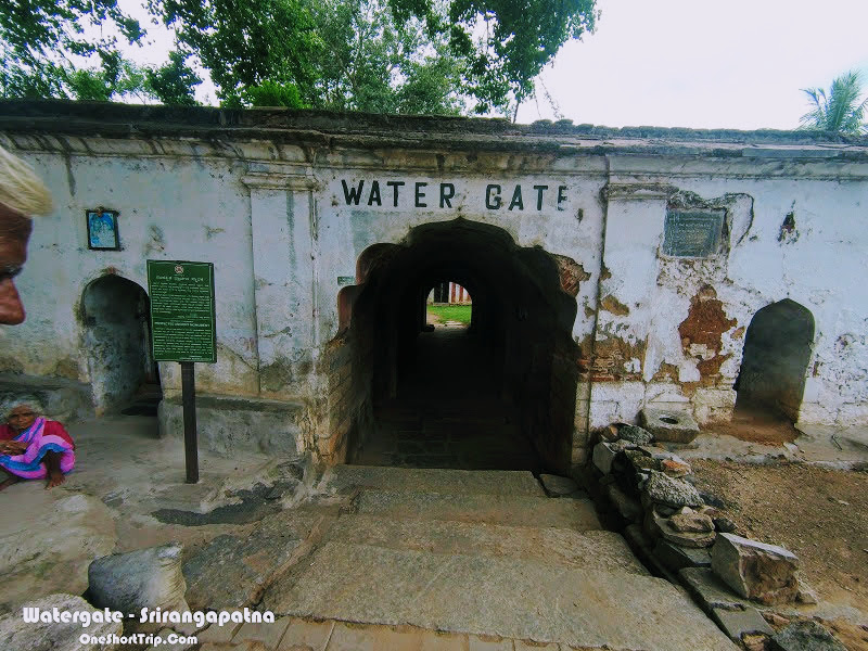
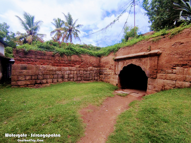
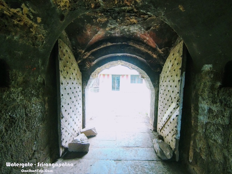
Water Gate – The Site of Tipu Sultan's Final Stand
The Water Gate is one of the most historically significant locations inside Srirangapatna Fort because it is associated with the final moments of Tipu Sultan's life. The gate was positioned close to the river and formed part of the fort's defensive relationship with the Cauvery.
During the final siege of Srirangapatna in 1799, British forces succeeded in breaching the fortifications. Tipu Sultan personally participated in the defence and fought amid the chaos of the assault. He was eventually killed near the Water Gate on 4 May 1799. The location therefore allows visitors to connect the surviving fortification with the final battle rather than viewing the fort merely as an architectural monument.
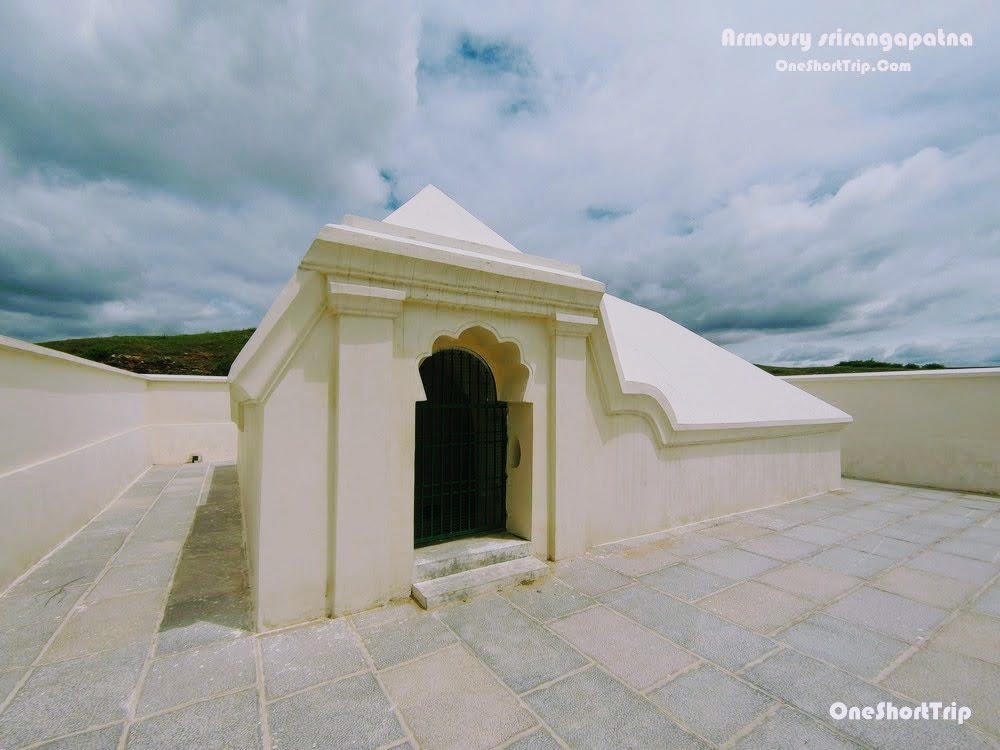
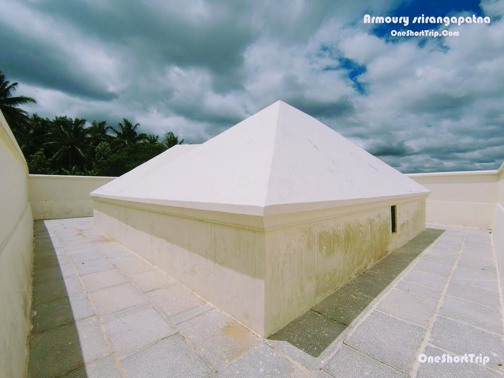
Armoury of Srirangapatna Fort
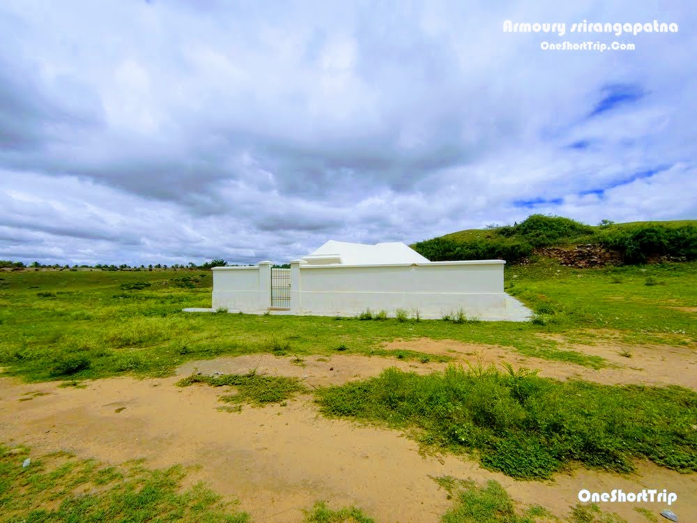
The armoury represents another important part of Srirangapatna's identity as a military capital. A fortress of this scale required substantial arrangements for storing weapons, ammunition and other military supplies, and the surviving armoury structures help explain how Tipu Sultan's state maintained its defensive capabilities.
Tipu Sultan's army was known for its use of firearms, artillery and military technology, including the famous Mysorean iron-cased rockets. The military organisation of the state depended on secure storage and distribution of weapons, making armoury buildings an essential part of the fort's infrastructure. Today, the remains provide an important connection between the impressive fort walls and the practical systems required to defend them.
Tipu Sultan's Death Place
The place where Tipu Sultan's body was found is among the most emotionally significant sites in Srirangapatna. On 4 May 1799, during the final assault on the fort, Tipu Sultan took part in the defence of his capital. He was killed during the fighting near the Water Gate, bringing his rule to an end.
The location is now marked as a protected historical site. The surviving marker is modest compared with the scale of the events that took place here, but that simplicity is part of its significance. Visitors can stand at the site and understand the physical setting in which the final moments of one of Mysore's most famous rulers unfolded. The ASI specifically lists the spot where Tipu Sultan's body was found among the protected monuments of Srirangapatna.

Colonel Bailey's Dungeon
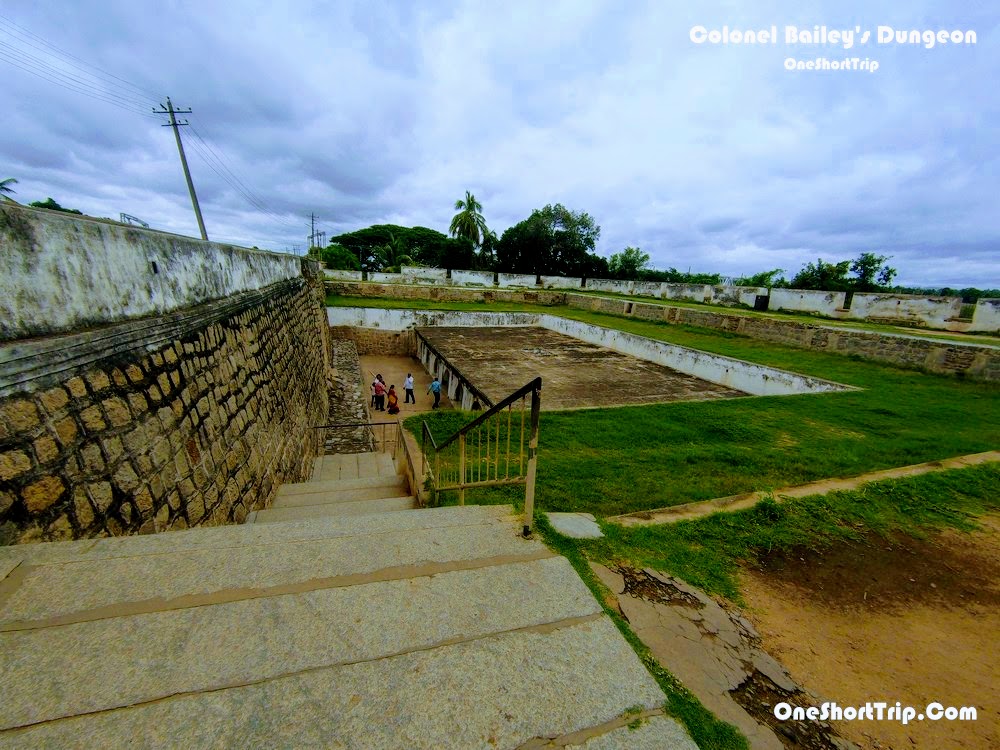
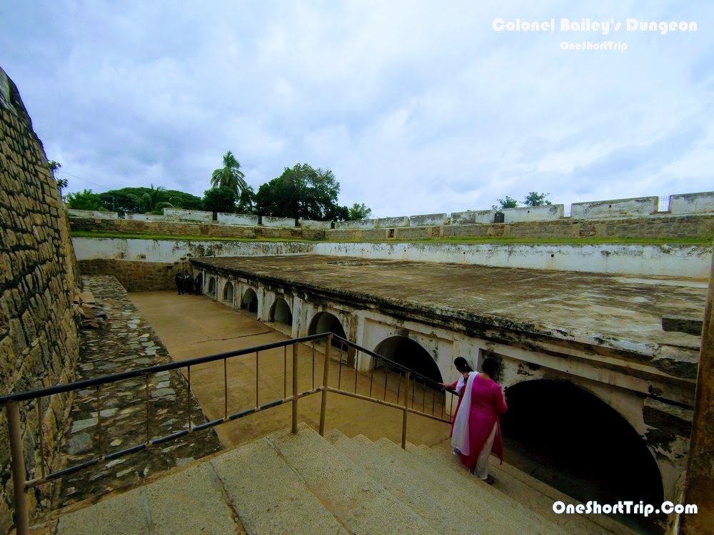
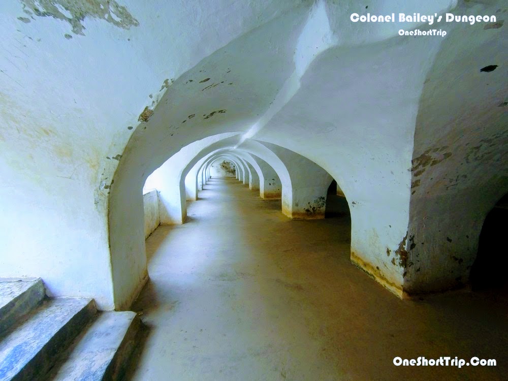
Colonel Bailey's Dungeon is one of the most well-known prison structures associated with Srirangapatna Fort. The underground dungeon is traditionally connected with the imprisonment of British officers captured during the Anglo-Mysore conflicts. Its location and construction demonstrate how the fort incorporated secure detention spaces within its wider military infrastructure.
The dungeon is partly below ground and has a heavy, enclosed character that contrasts sharply with the open spaces of the fort. Its association with British prisoners has made it one of the most visited military-history sites on the island. The name is traditionally linked to Colonel Bailey, who died in captivity after being captured during the Second Anglo-Mysore War, although the surviving structure served a wider prison function.
Lal Mahal Palace
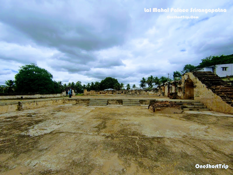
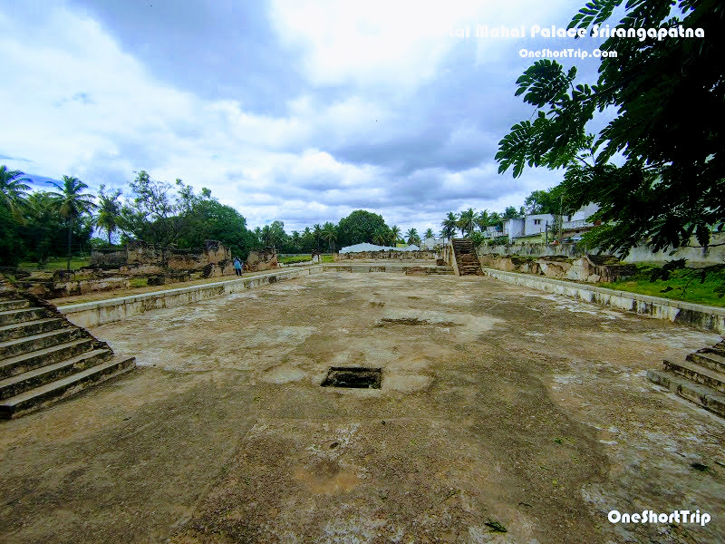
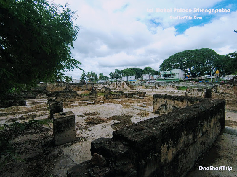
Lal Mahal, or the Red Palace, was one of the royal structures within the fortified capital. Today, much of the palace has disappeared, leaving archaeological remains and traces that help establish the scale and organisation of Tipu Sultan's royal centre.
The palace formed part of a larger royal and administrative landscape rather than functioning as an isolated monument. Its remains are particularly important because they show that Srirangapatna Fort was not merely a military installation. It was a living capital containing residences, administrative buildings, places of worship, military facilities and public spaces. The ASI lists Tippu Palace–Lal Mahal among the protected heritage monuments of Srirangapatna.
Jumma Masjid – Masjid-e-Ala
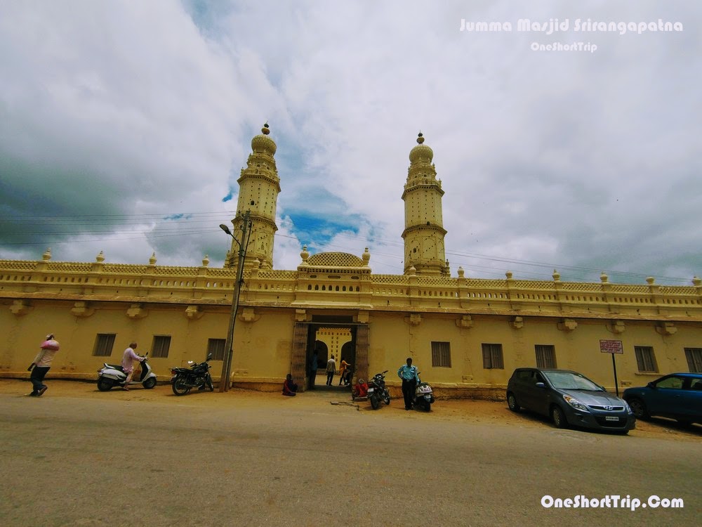
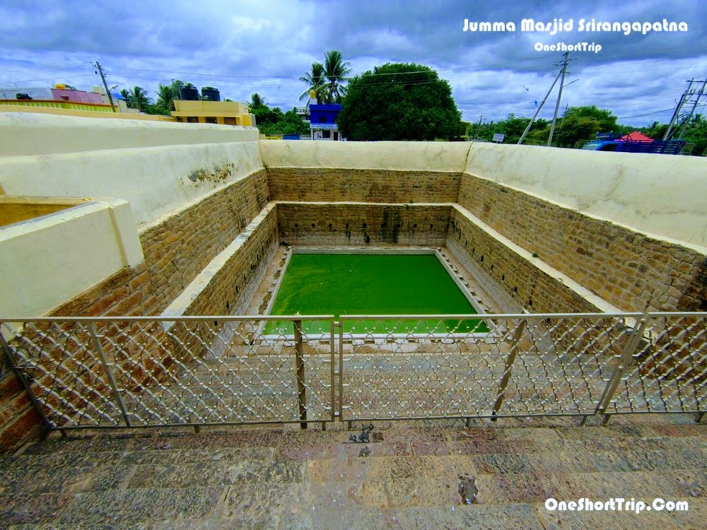
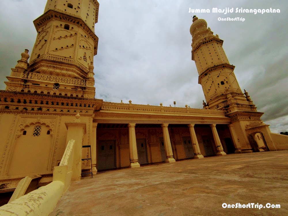
Jumma Masjid, also known as Masjid-e-Ala, is one of the most prominent Islamic monuments associated with Tipu Sultan's Srirangapatna. The mosque was built in 1784 and reflects the architectural character of Tipu Sultan's period. It remains an important religious building as well as a significant part of the fort's historical landscape.
The mosque has two levels, a spacious courtyard and a prayer hall, with two prominent minarets. The minarets contain internal stairways with roughly 200 steps. Decorative motifs and inscriptions add to the architectural character, while the walls contain the 99 names of Allah. A historic clock is also associated with the mosque. A madrasa operates within the complex, reflecting the building's continuing religious role rather than leaving it as a purely archaeological monument.
Thomas Inman Dungeon
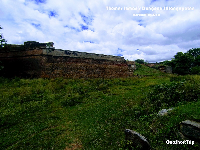
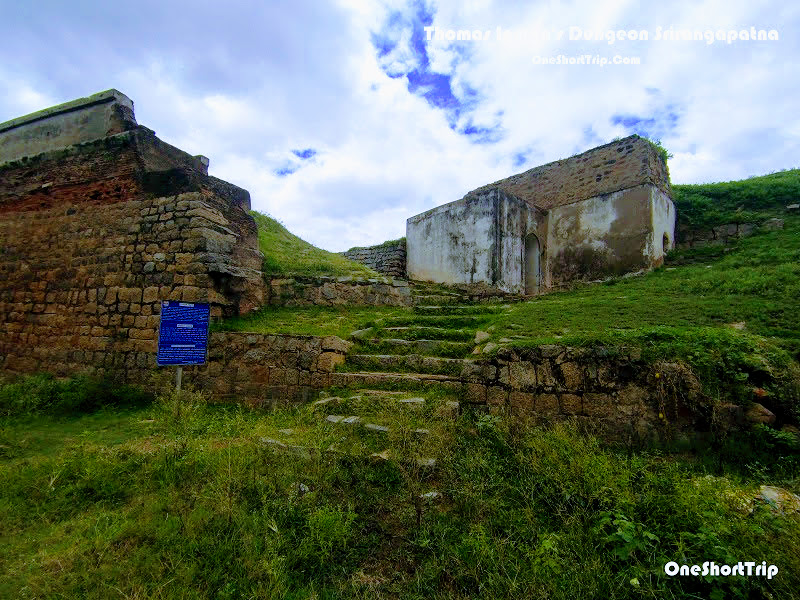
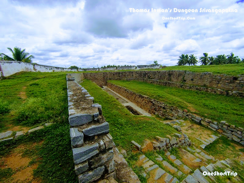
Thomas Inman's Dungeon is another historic prison structure within the Srirangapatna fort complex. Like Colonel Bailey's Dungeon, it illustrates the importance of imprisonment and military detention within the fortified capital during the Anglo-Mysore period.
The dungeon is associated with the detention of prisoners during the period when Srirangapatna was at the centre of conflict between Mysore and the British. Its underground construction, confined spaces and heavy masonry provide a stark impression of the conditions under which prisoners were held. The ASI recognises T. Inman's Dungeon as one of Srirangapatna's centrally protected monuments.


The Obelisk and the 1799 Battlefield
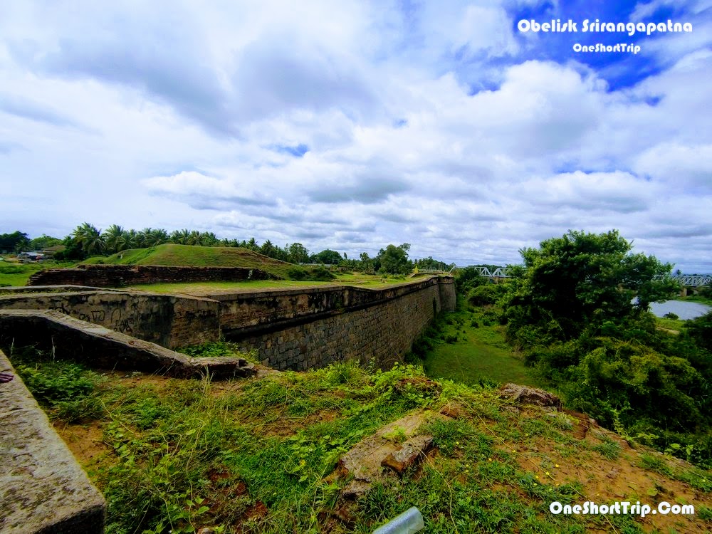
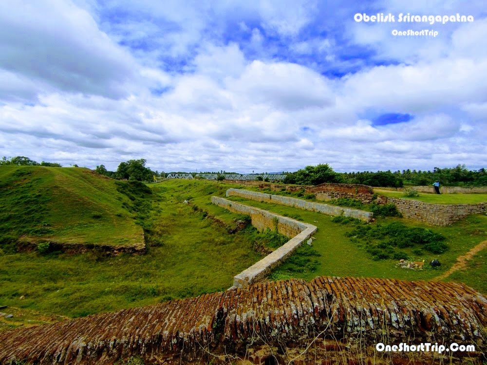
The Obelisk is a commemorative monument connected with the final siege of Srirangapatna and the death of Tipu Sultan. It stands near the area where the decisive breach occurred and commemorates the British victory in the final Anglo-Mysore conflict.
The surrounding fort walls are particularly important because the breach in the defences allowed the attacking forces to enter the island fortress in 1799. The Obelisk therefore has significance not simply as a standalone monument but as part of the larger battlefield landscape. The ASI recognises the Obelisk monuments and fort walls near the breach as protected heritage.

Architecture and Defensive Design of Srirangapatna Fort
The architecture of Srirangapatna Fort reflects its unusual location on a river island. The Cauvery itself formed a natural defensive barrier, while artificial fortifications strengthened the vulnerable approaches. Thick masonry walls, gateways, controlled passages, dungeons, military storage areas and strategically positioned defensive structures were combined into a system designed to protect the capital.
The fort also demonstrates the cultural complexity of Srirangapatna. Hindu temples, Islamic monuments, royal buildings and military structures coexist within the same historical landscape. Karnataka's heritage documentation describes the monuments of Srirangapatna as an important combination of Indian, Indo-Islamic and later British influences, developed over centuries of continuous occupation.
Srirangapatna Fort and the Anglo-Mysore Wars
The fort's history is closely tied to the four Anglo-Mysore Wars fought between the Kingdom of Mysore and the British East India Company and their allies. Srirangapatna became the centre of Mysorean resistance because its island location and fortifications made it exceptionally difficult to attack.
The final conflict in 1799 brought the largest military crisis to the island. After the fort was breached, fighting moved into the fortified city itself. Tipu Sultan refused to abandon his capital and died during the defence. The fall of Srirangapatna fundamentally altered the political balance of southern India and placed the Mysuru state under a new political arrangement dominated by British power.
Other Important Heritage Sites Around the Fort
A visit to Srirangapatna Fort should not be limited to the walls alone. The island and its surrounding area contain a remarkable concentration of historic monuments. Important sites include the Sri Ranganathaswamy Temple, Daria Daulat Bagh, Gumbaz, Jumma Masjid, Colonel Bailey's Dungeon, Thomas Inman's Dungeon, Tipu Sultan's death place, the Lal Mahal remains and the Obelisk and battlefield area. Karnataka's heritage documentation identifies these monuments as part of Srirangapatna's exceptionally important historic landscape.
Best Time to Visit Srirangapatna Fort
October to February is generally the most comfortable period for exploring Srirangapatna because temperatures are more pleasant for walking between the fortifications and monuments. The monsoon months can make the Cauvery landscape especially scenic, but wet surfaces and stronger river flows require additional caution. Karnataka Tourism also identifies the cooler months as a favourable period for exploring Srirangapatna's historic sites.
How to Reach Srirangapatna Fort
From Mysuru: Srirangapatna is approximately 14–20 km from Mysuru, making it one of the easiest historical day trips from the city.
From Bengaluru: Srirangapatna is roughly 130–135 km from Bengaluru by road and can be visited as a day trip or as part of a Mysuru itinerary. The town has road and railway connectivity.
Tips for Visiting Srirangapatna Fort
- Wear comfortable footwear because several monuments require walking between different sections of the historic island.
- Start early if you want to cover the fort, dungeons, Jumma Masjid and other nearby monuments without rushing.
- Carry drinking water, particularly during the warmer months.
- Some religious sites continue to function as places of worship, so dress respectfully and follow local instructions.
- Do not climb restricted fort walls or enter protected areas that are closed to visitors.
- Be particularly careful near the Cauvery River, especially during the monsoon and periods of strong water flow.
- Photography rules can differ between individual monuments, so follow the instructions displayed at each site.
- For a deeper understanding of the history, consider visiting the monuments in chronological order and reading about the Fourth Anglo-Mysore War before exploring the battlefield areas.
How Much Time Do You Need?
A quick visit covering the principal fort areas can take around two to three hours, but travellers interested in military history, Tipu Sultan, architecture and the Anglo-Mysore Wars should allow at least half a day. If you also include Daria Daulat Bagh, Gumbaz, Sri Ranganathaswamy Temple and other monuments around the island, a full day gives a much better experience.
Why Srirangapatna Fort Is Worth Visiting
Srirangapatna Fort is not simply another historic fort near Mysuru. It is a place where the physical remains of a capital allow visitors to follow the story of a powerful kingdom, its military ambitions, its religious traditions, its royal life and its final confrontation with the British. The Delhi Gate explains the defensive system, the armoury reveals the military character of the capital, the dungeons reveal the realities of wartime captivity, Lal Mahal represents the royal centre, Jumma Masjid reflects the Islamic architectural heritage of Tipu Sultan's reign, and the Water Gate and Obelisk connect the visitor directly with the dramatic events of 1799.
Taken together, these monuments make Srirangapatna one of Karnataka's most rewarding heritage destinations. The island's combination of river landscape, fortifications, temples, palaces, mosques, prisons and battlefield monuments creates a historical experience that cannot be understood from a single structure alone. To explore Srirangapatna properly is to walk through the remains of a former capital and one of the most consequential military landscapes of eighteenth-century South India.
Planning A Trip Here?
Get help planning your visit — call or WhatsApp us and we will help you book a tour.